Sorry folks, I seem to have gotten behind in my greenland posts and never published this one.
The ice damed lake is the large blue green lake right of center on the map below
The lake before it drained…note the water level on the ice, in the post drainage images the previous water level is clear from the "shelf" on the glacial front

The scar on the hillside at the right of this photo (below) lines up with the scar seen in a couple photos down.
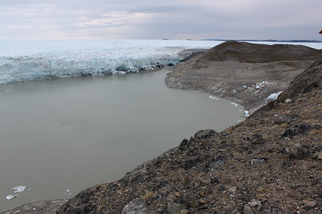
Lake after draining.
The line along the ice front was the original water level.
In this image, the ice dam/drainage point is off the image to the right of the photo. The water in the foreground is just a small lake.
The hill right of center in the next two images, with the bare patch in the middle, is the same as the dirt scar two photos up. The highest light line marks the high water line before the lake drained.
The shelf on the ice terminus makes the high water line. Below the waterline were many holes, potentially sub-glacial drainage conduits??
The ice dam, and lake outflow are to the right of the photo.
Lake outflow channel, looking toward the lake basin
Ice dam (right) and lake outflow channel
Our river crossing cables (location in map at top of post), attached to rebar and climbing bolts were pulled free and mangled by the outflow waters.

Ice rafts far down river of the ice dam and up shore from the main river channel (image taken near sub-glacial sample site)


