Mt
Rainier Summit Caves Expedition:
The 2014 expedition to the Rainier summit
ice caves consisted of: a cave mapping team from Oregon (Eduardo Cartaya and
Co.) and Canada (Nick and Christian); a professional photographer, François-
Xavier (Fix), and his assistant, Colin Pither, from Vancouver; a Seattle Times
journalist, Sandi Doughton; Bill Lokey, the expedition coordinator who help map
the caves for the first time in the 1970s; Matt Bachman, Ph.D., USGS; Steve
Warren, Ph.D., UW ESS glaciologist; Zoë Harrold, Ph.D., geomicrobiology.
The group was roughly broken into 3 teams
– the OR mappers, the Canadians, and the scientists + Bill and Sandi. The OR mappers planned to summit in 2 days
while the rest of us planned on a 3 day, 2 night approach with our first night
at Muir, and the second above Disappointment Cleaver. This would allow for more time to acclimatize
and rest since we all carried full packs (50 -70 lbs)
I am approaching the
geomicrobiology of the Rainier summit caves in the interest of advancing our
understanding of extraterrestrial and early earth life. My goals are to
hone in on the metabolic processes and trophic structure, in particular the
chemolithoautotrophs, of the endogenous microbial population supported
by the cave system. I planned to collect geochemical, microbial and
mineralogical samples from the fumaroles, firn walls and any rivers or lakes
within the cave system.
Day 1, Monday, August 11th,
2014 – Hike from
Paradise to Camp Muir ~ 6 hrs. The
approach was uneventful as expected but provided some time to chat and get to
know each other before roping up. The OR
caving mapping team continued on to Ingraham Flats that evening and planned to
summit the next day. We would take a
slower approach, with plans to make a high camp above Disappointment Cleaver.
Hiking up the snowfield - Tatoosh range in the background.
Bootpack up the muir snowfield with the summit in sight.
Our campsite at Muir. The peaked tent is Bills Denali tent from the 60's!
Debriefing with the Muir Rangers. From left: Bill, Ranger, Colin, Sandi
Evening light and storm clouds, looking down the Cowlitz glacier from Muir
Day 2, Tuesday, August 12th,
2014 – We
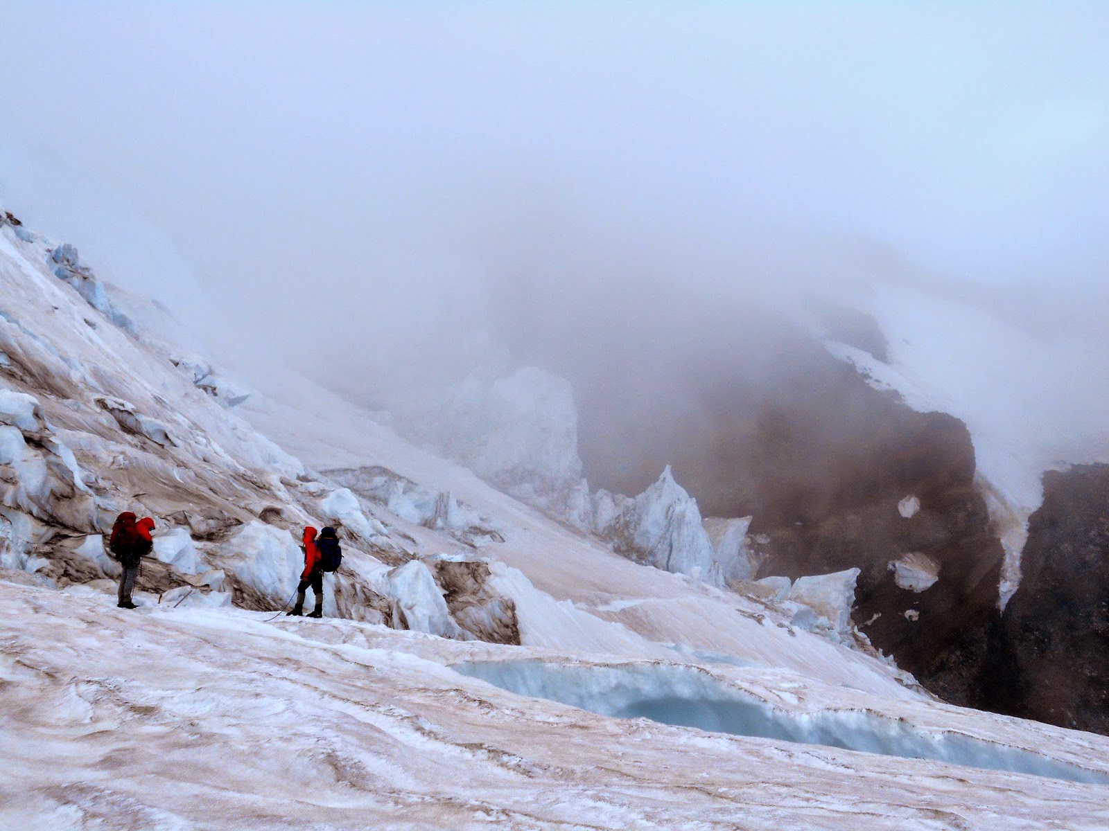
left camp Muir around 9:30 am and headed up the DC. One ladder bridge spanned a particularly wide
crevasse and a snow bridge spanned from the Ingraham glacier to the
cleaver. The Cleaver itself was a
scramble on bare rock. We reached the
top of the cleaver around 2 pm and set up High Camp just as a storm was rolling
in. The storm turned out to be a
whopper, with electrical charges building overhead, making our avy poles hum
and my hair stand on end. We all
eventually made our way to the only “safe” place we could find, a shallow ditch
below the emergency cash containing a ladder – lightening rod!? (next to O2 bottles…sweet.) After about an hour of crouching in the
blowing snow and lightening we gave in and made our way to the warmth of our
tents and sleeping bags. I knocked snow
off the tent every couple hours during the night to avoid overloading the tent
walls or suffocation. A few rouge
lightning flashes illuminated the tent late into the evening. The snow and gusting wind (30- 40 knots? - my brain is tuned to knots from my work in bar Harbor, I think its roughly the same in mph)
continued throughout the night, leaving us with little sleep.
Preparing to disembark from Muir; from foreground: Bill, Matt, Fix, Colin
Fix and Colin on the Cowlitz
Crossing the ladder bridge, Little Tahoma in the background
From foreground: Steve Warren, Nick and Christian (Canadian cave mappers)
View of the summit from High Camp (top of DC)
Day 3, Wednesday, August 13th,
2014 – The morning
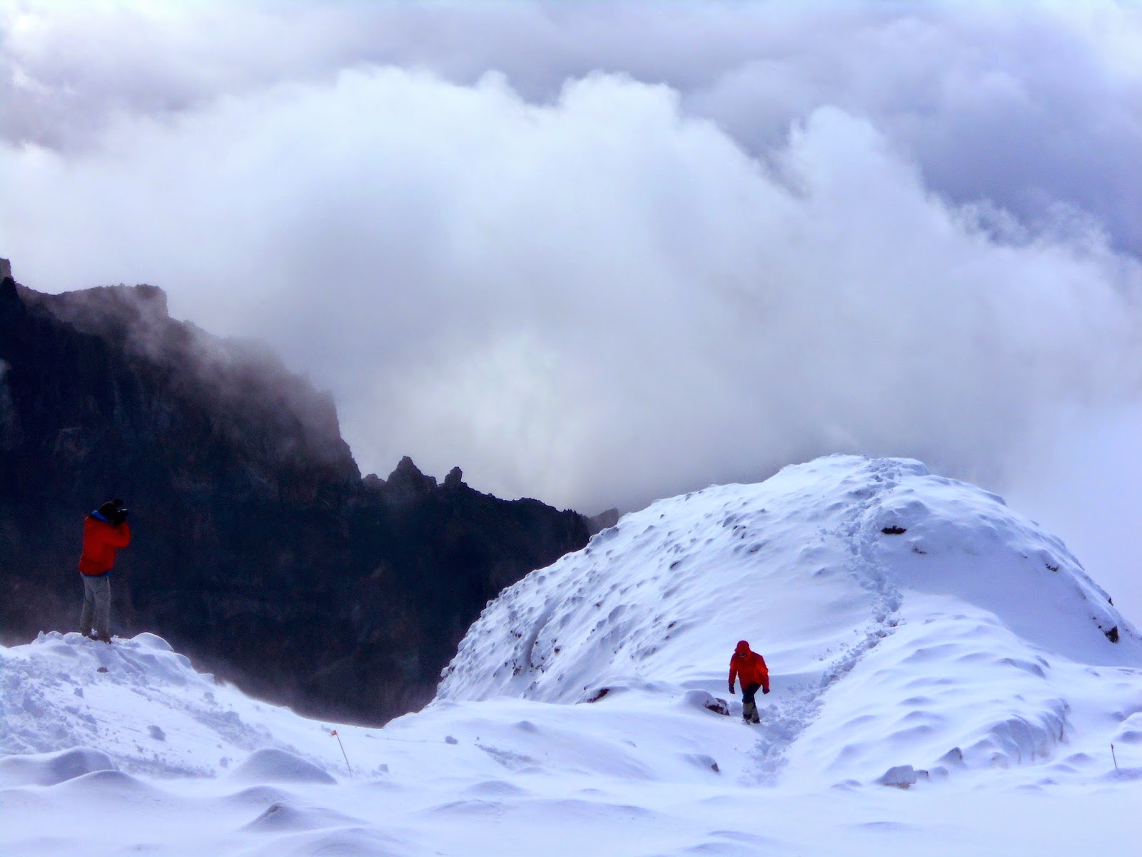
greeted us with more snow and fog, urging us to sleep in until 9 or 10 am. Eventually everyone mobilized and the clouds
lifted, revealing a clean white blanket of snow over Rainiers glaciated
slopes. The typically clear and
compacted steps of the DC route had been erased by a foot of accumulation – the
route was gone. Due to the potential Avy
danger from wind loaded slopes and fresh snow, more T-storms predicted that
night, and no obvious route we decided to descend to Camp Muir.
Discussions
as to our next move took place throughout the day. With poor weather predicted, potential avy
danger, no route and the potential of getting stuck on the summit - motivation
was running low. Ultimately the two
Canadian mappers and Steve Warren decided to call the trip. Hearing the prospect of another attempt – I
decided to stick with the plan in hopes of sleeping on the summit, exploring
the ice caves and getting some samples.
In another turn of events Fix and Colin decided to make an alpine start
summit bid from Ingraham flats the next day, to beat the weather and catch the
OR caving team for a photo shoot in the caves before they descended. The guys invited me to join them – I of
course agreed. We packed, ate dinner and
went on our way, reaching Ingraham flats and setting up camp around 8 pm.
Colin on the DC. The high clouds cleared in the morning, revealing this scene.
Exhumed gear at the top of the DC
Colin being a hero.
Fix (L), always ready to capture the moment. Colin (R)
Day 4, Thursday, August 14th,
2014 – The perk of 3
people in a 2-man tent is that I was really comfortably warm all night! Fix, Colin and I woke up around 1 am. After a hot breakfast and some photos we
packed up camp and got on the trail at about 2:30 am. Having a camera in your face while trying to
drink morning tea still felt unnatural…I’d eventually get *sort of used to
it. We soon caught up with the caboose
of the guided climber train. The girl in
the middle of the rope team ahead of us had put her gaitors on backwards – if
she could climb this thing, I definitely could.
We clambered up the Cleaver under a cold clear, moonlit sky.
Once at the top
of the cleaver we again caught up to the guided groups who were taking a break
on the tent platforms we had constructed the night before. The route was still obscured by snow, so we
waited for the guides to rally and break trail.
We watched as the train of climbers started up, the lead guide sweeping
the area with his headlamp, looking and probing for crevasses. It was slow going, breaking trail. So we sat and waited until the cold night
chilled us to the core and urged us to start moving. Inevitably we caught up to the guided train
again, but the rests were welcomed and gave Fix a chance to take photos of the
view and cloud cover below.
By the last 500’
of the climb we were slowing down and struggling a bit. The crater ridge was in sight, and seemed so
close, but remained elusive for the next hour.
The last low-angle plod seemed to take much more effort than it deserved. We were all elated when we finally reached
the crater flats to see the cavers camp site and main cave entry just to the
left of the main climbers trail. We
dropped our heavy packs and attempted to re-fuel and –hydrate. Within 30 -45 min we had regained our energy
and resolve and scampered into the cave with Fix to help photograph the OR cave
mapping team before they set off down the mountain.
We found the cave
mappers in the largest of the chambers.
Fix set to work setting up shots.
Colin and I held flashes to cut thought the fumarole fog and illuminate
the scene. The photo shoot took about 2
hours and included a series of actions shots, portraits and a short interview
with the cavers. Once done, the mappers
headed on their way. We slowly made our
way back to the entrance. It was easy to
forget we were at 14,000 ft while inside the confined darkness of the
caves. As we worked our way back to the
entrance and up the steep, unconsolidated scree passageways, we often found
ourselves out of breath. We eventually
made it back to the surface and were blinded by the bright afternoon sun
reflecting off the snow covered crater.
It was finally time to take a proper break!
We set up camp – which
seemed inordinately difficult and slow… laid out our sleeping bags and relaxed
for the remainder of the day. That night
we decided to try a Mediterranean meal mix – which I now call Mediterranean Surprise. Despite our recent hunger, we were somehow
only able to put away half of the concoction – it was a gloppy, salty yet some
how rather flavorless mess…the reminder got blue bagged and we washed our
gullets with a round of tea and chocolate. I think at this point Colin was day-dreaming about freeze dried Big Macs.
Regrettably, I left my Canon EOS T1i at Paradise, it would have preformed better in the caves and overall, but I've found a crappy point and shoot does a decent job above ground - at least for my standards :) Next time…whats another 1.5 lbs!? (I have one of the lightest, basic D-SLRs on the market, not by mistake) once you have a full pack.
Fix at the lead for the ascent. Waiting for the guided groups to pack the trail ahead.
Day 5, Friday, August 15th,
2014 – I
awoke several times with a solid headache but avoided advil for awhile in an
attempt to correct it by hydrating and eating.
We all suffered from the altitude in one form or another over the course
of our time at or near the summit – fortunately though, our ailments were not
life threatening. By around 9 am we were
fully awake and refueled. Our goal for the day was to find the lake and do some
exploring. We headed into the cave, made
it to the main corridor, took a left, and happened upon the large icy blue pool
sooner than we expected. Fix set about
preparing his photo shoot, I set about preparing my sampling equipment.
(note:
this gets nerdy, though you all should expect nothing less :) ) The lake was estimated at 37 m x 10 m x 5 m deep. It lies along the southern branch of the East
crater caves on the northern side of the cave wall. The chamber floor was composed of highly
saturated mud. In other chambers of the
main cave system, floors with similar compositions were either unconsolidated
or solid and potentially frozen. A steep
mud and gravel ridge bounds the southern edge of the lake while the northern
edge is constrained by the firn cave wall.
Platforms or steps in the ice boundary at the eastern most bank may
indicate past lake levels. The west bank
of the lake rises steeply upward and shows some signs of water flow from the
western portion of the cave into the lake.
Based on qualitative assessment the humidity in the lake chamber was
lower than that of the amphitheater sized chambers. No active fumaroles were identified in the
chamber. Water dripped steadily from the
ceiling, but seemed to occur in volumes similar to those observed in other
chambers of the cave system.
I sampled
the East crater cave lake at its “far-side” (RSC-1) around 11 am. From here, I’m going to keep the details of
my samples out of the story. Suffice it
to say, I took samples to study the geochemistry, mineralogy and microbiology
of the cave system, including the lake and some active fumaroles. I used the back of my pack as a working
surface and sat on one of the large sample bags I had brought. The bank of the lake and spot where I had set
up shop was a mucky and unstable mess – not the ideal conditions to work in and
nearly impossible to write sample labels or keep one’s gloves even remotely
clean. It reminded me of the terminus of
the ice cliff waterfalls in Thule, Greenland – “quick mud” when you least
expected it! Colin graciously chipped off a bag of firn wall
for a sample that I would ultimately bring back to MSU to process. This bag of ice, while amusing to carry down
the mountain, served as an ice pack for my samples –efficient eh!? Also at this point I’ve noticed myself starting
to say “eh?” – Canadians. ;) I could easily see myself living in Canada.
Estimated locations of sample sites and explored
cave sections based on 1970s map. Cave
system is reportedly more extensive than this map suggests based on the 2014
surveys.
After about 2 hours at the lake I wrapped up my basic
sampling goals and we moved on to explore a bit more of the cave system. We found a fairly large fumarole complex in a
section of fractured bedrock that hosted a blanket of white stalagmite
precipitates and massive precipitates that, at least in the light of my headlamp,
appeared yellow, red and white. I
collected a range of these samples and Fix busied himself and Colin with
another photo shoot.
Our explorations somewhat mistakenly
brought us to a different exit from the cave system and we popped out southwest
of our campsite on the crater rim. I
don’t think any of us really had any idea where we were going to surface
at. Being in the ice caverns had us all
sufficiently turned around and distances in the dark, steep floored chambers
are difficult to gauge. Our timing was
perfect though- Bill, Sandi and Matt made the summit just minutes before we
surfaced and were getting set-up in camp.
We greeted them, traded stories and spent the rest of the day
relaxing. Given the conditions of the
cave – dark, cold and steamy – my samples were a total mess! Grimy, damp and
labels already rubbing off – in fact the labels on two glass vials had rubbed
off…fortunately I was fairly tuned in to the details in these vials and
recalled which one had the less than ideal head-space bubble (I know- nerdy J ). I took some time to make sure the vials were
cleaned up, properly labeled and microbially “fixed.” (amusingly, when I got the samples back to
the lab- they were still filthy!).
That
night I awoke with another solid headache.
I attempted to rub some of the dirt off my face and nose – which
precipitated a massive nosebleed – not unsurprising given the elevation and
dryness. But it looked like total
carnage…it was dark, I could not find my headlamp or the tissues... So my foraging for these things left – well,
tracks. I first tried to find the headlamp
and attempted to wake up Colin for some assistance. Eventually I found the headlamp and “science
tissues” (kimwipes) I had brought for research – these came in handy in more
ways than just work… J. By the
time I was cleaned up I had already gotten blood all over: on my sleeping bag,
my jacket, colin’s sleeping bag and the tent wall and celing! HA! The scene was
complete with a small mountain of bloody tissues in the corner of the tent…
Oops. I tried to clean things up- mostly
my jacket and sleeping bag, and then gave in and went back to bed. I think Fix woke up first and saw all the
blood – and was immediately worried about Colin. Hahaha I’ll take that as a compliment that he
assumed I was totally fine with the altitude.
When Colin got up and saw the mess we had a good laugh about the
apparent carnage in the tent – it looked like something had been killed in
there. I asked for a garbage bag and
discarded the horrible mass of reddened tissues. I’d say Colin’s approach to life is similar
to my family’s: once everything is ok, or is just uncontrollable, we get a good laugh
out of it (like metal ladders next to oxygen bottles in a lightening storm –
sweet), Fix as well, though he’s more reserved about it. Eventually the story got cleared up –
everyone was relieved it wasn’t from Colin; “what am I, chopped liver!?”
;) Colin and Fix– very sorry about your
sleeping bag and tent, respectively – something to remember me by?
Day 6, Saturday, August 16th,
2014 – The plan for
the day was to explore the East and West crater caves and do a photo shoot with
Bill, Sandi and Matt. Matt also needed
to take water samples and plant some contraptions for gas sampling. Though we had planned in nap times, they
didn’t really materialize and it turned out to be a long day for everyone. Fix got an early start at 4 am with Matt,
Bill and Sandi – their goal was to plant the gas sample contraptions and
document the work. Colin and I slept in
for a bit before mobilizing later around 8 am.
We all ventured into the cave and explored the sections past the
amphitheater sized caverns. We got lucky
with the exit pathway we choose and found the remnants of the plane that had
crashed in the ‘40s. We eventually
exited the caves to the northwest of our campsite and made our way back for lunch.
Returning to camp from below. East Crater. L to R: Sandi, Bill, Fix, Colin
After a relatively quick refuel, I headed to
the West Crater cave system with Bill and Matt.
I was already tired and took my time hiking up and over the rim
separating the craters. Inside the west
cave we worked out way through a narrow passageway that required me to scoot
under a low ceiling and across hoar frost and dirt. The fumaroles in this cave were emitting a
concoction of sulfide gasses, identifiable by the smell. This was rather concerning given the closed
spaces and potential toxicity of the gasses – so we kept and eye on Bills gas
monitor and the airflow; and kept our visit short. The west crater lake that had been identified
in the ‘70s was gone, with not apparent outflow channel. We made our way back to camp – during which I
scooped up a few more hand samples and signed the summit register (yes, it took me 6 days to summit Mt. Rainier :P haha)
At 6:30 pm Matt had yet to
get his water samples from the existing east crater lake – so I volunteered to
guide and accompany him there after I had rested in the tent and
refueled. At 7:30 pm I begrudgingly put
on my mud smeared waterproof gear and cold boots and we made our way into the
cave. Admittedly I also needed to
collect a few more samples from the lake, so it was good to have another reason to go back that night. It was twilight when we entered the
caves – a foreboding time of day to be entering into a dark cavern since the
cave exists are beginning to fade with the sunlight. I felt more apprehensive about being in the
cave than any other time that trip.
Along our descent I left cairns and made mental notes of obvious
landmarks. We made it to the lake
without a hitch and collected our samples within an hour. Once done we high tailed it out of there – as
fast as on can at 14,000’ – reaching the surface within 20 minutes of leaving
the lake. I was glad to be out of the
caverns and back into now dark but expansive east crater. I crawled into bed and drifted off to sleep
with an odd lingering feeling of confinement inside the tent walls. One thing had been remedied though – for the past 2 nights my head
had been lower than my feet in the tent.
A factor I believe contributed to my morning headaches, bloody nose and
sometimes swollen hands. Before I
returned to the tent, Fix graciously propped up my sleeping spot with his pack
to level things out – my nighttime ailments were greatly diminished.
Day 7, Sunday, August 17th,
2014 – Matt and Bill
woke up early to retrieve the gas samplers.
I worked on prepping breky and water for the descent, digging out our
frozen in tent stakes (ice axes etc.).
It took me a solid 30’ to find and dig out my blue bags – ugh. And then
retrieve my bagged-ice sample which was frozen into the snow–I unfortunately
put a hole through the bag with my ice axe.
We eventually got packed up and began the descent together – keeping
close to assist the other rope team if necessary (Bill, Matt and Sandi; Fix,
Colin and I).
Once past the
snow and ladder bridges and back to Ingraham flats, we parted ways and sped off
towards Muir. Fix understandably had his
wife and baby girl–to-be on the brain – likely giving him some extra speed
that day. Colin is probably always
insanely fast. After a break at Muir we continued on to Paradise, splitting up based on
speed – I felt severely limited by the weight on my back as I attempted to not
face-plant while trying to ski-glissade down the snowfield. It was nice to pick up the pace and
make it down quickly though – as the snowfield descent is an extremely boring
but inevitable part of the climb. Colin
and I both wished we had skis. I
eventually made it down (I think we all mistakenly took the long way –oops!)
and connected up with the guys. From
here we packed the car and headed back to Seattle/Vancouver.
Overall it was a very
successful trip – though at times it seemed we were not going to reach the
summit. Many new connections and friends
were made along the way – as often happens when you thrown into a mountain
setting with like minded folks, eager for an adventure and away from the complications and distractions of city life.
Future Plans:
I hope this work will
become a minimum, two year research endeavor for me, during which I will be based
out of MSU, Bozeman, MT. The research I
plan to conduct includes a suite of geochemical, mineralogical and microbial
analyses, both from field samples and laboratory manipulated and
controlled microcosms. Future field sampling may involve depth transects within
the lake and/or lateral transects from cave openings or across geochemical
gradients. In conjunction with this work I am very interested in what the
caving team discovers in terms of cave atmosphere throughout the
system. I expect the cavers also noted this, but we smelled sulfurous
gasses in the West crater cave system that was not noted in the East crater
system - a distinction that could be better made with accurate atmospheric
analyses. - let it be known - if you got this far in the post ;) I'm staking my claim on the geomicrobiology of this field site!