Saturday, September 29, 2012

If I keep going south, climbing season doesn't end!

Smith Rock, OR

I currently have a larger issue limiting my climbing than weather: a pulled? or evulsed? A4 pulley.  Just google "climbing finger injury pop"  In fact, there is a whole Wikipedia page on "climbing injuries".  Mine is textbook: pulling hard on a crimper (a small hold you can only get your finger tips on) when you hear a "pop" sound and some pain ensues...I head three pops, two out of three fingers recovered in a couple hours, the third is still swollen after 6 days.


BUT, I had already planned to go to Smith Rock near Terrebonne, OR last weekend. So, I went anyways, three days post injury.  Smith Rock is one of the most scenic places I've climbed.  When you drive into the state park you are immediately confronted by towering limestone cliffs jutting out of a green river valley.  The rock is a mixture of golds, reds, blacks and browns.  There are cracks, huecos, chicken heads, knobs and crimpers.  Towering walls exhibit massive conchoidal fracture patterns hinting to historic rock fall events that would have shaken the ground.  Spires at the cliff tops extend upward like gigantic stalagmites, eroded by thousands of years of acidic rain.  In one formation a boulder perches atop a rock pedestal.


You can use a nut tool to slice cheese...this is how you clean it after you slice the cheese.

Christian, working a 5.12 (?)
I addition to the scenery I couldn't have asked for better company!  Four of us, Alex, Greta, Kristian and I, made the 6 hour drive from Seattle to Smith. 

I attempted to climb without using my ring-finger.  Every move was a bit T-rex style, grabbing holds with only three fingers.  Alex and I climbed a couple multi-pitch routes; Alex taking most of the leads so I could favor my hand.

Alex's victory


Greta on rock (5.11); Kristian on Belay


Sunday, September 23, 2012

Mt Thomson

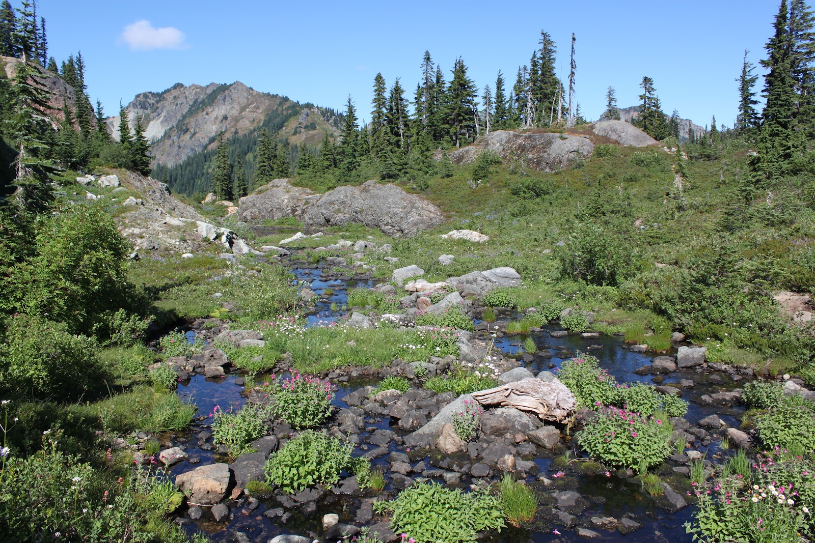
On September 15-16, 2012, I jumped on a Backpacking/Alpine Climbing trip with Brian, Laura and Craig.  We hiked the PCT from exit 51 off I90 for about 11 miles: we took a 4th easy 5th class detour scramble up Kendall peak, traveled across the Kendall Catwalk, past Ridge and Gravel Lakes, around Alaska Lake to a col between Huckleberry and Chickamin Peaks.  We found the some lingering patched of late lying snow in the meadows on the col and made camp by the best water source in the area, a small, slow flowing spring.  Over the course of 5 hours the water source in camp surprised us by filling a tarn that Brian and Laura had initially set up their tent in!  We were sure the tarn had been dry for quite awhile, but by morning it was full of 6" of crisp clean water!  Smoke, we believe from the fires in the East, had settled in the valley Sunday morning.  It was thick, obscuring more distant peaks, and palpable, leaving us with a metallic taste in our mouths.  The air felt heavy.

Craig and I branched off and summited Mt. Thomson via the west ridge, an alpine route that goes at 5.6.   Though I have no photos of Mt. Thompson!  I left my camera at bumble bee pass knowing I'd be more focused on the ropes and my feet.  We completed the climb in 5 pitches and topped out by 3:30pm.  Craig lead the whole thing! since I was feeling a bit heady from the exposure.  The first two pitches were the most sustained vertical pitches, with the crux at the start: a step out from the belay ledge over some heady exposure, with no real great hand holds.  The route continues fairly vertically until you reach the slabs (visible from the valley) on the third and fourth pitches.  Seams and weathering along the slabs provide great footing while also feeling wonderfully open and exposed.  While the scramble across is easy, the pro is limited and a fall would result in a long swing.  After crossing the slabs you climb vertical over the false summit, scramble down to the next belay ledge and back up the true summit for the final pitch.  The descent route required 2 rappels and some class 3 and 4 down scrambling.  We reached the valley by 5:30pm.
On the Scramble to Kendall peak, Craig on a false summit. 

Looking back from Kendall Ridge.  I believe Mt. Thompson is the prominent peak on the horizon at the left 

Hazy Mt. Rainier (Saturday) 

Smoky sunset at camp


Rachel and Ramparts Lakes

Mai, Stu and I hiked to Rachel and Rampart Lakes in the Alpine Lakes Wilderness on September 3, 2012.  The trail is about 11 miles round trip, gaining the majority of the elevation before Rachel Lake.  I highly recommend this hike! The lakes are beautiful and the distance and elevation gain a perfect for a relaxed day of hiking with fantastic payoff without summiting a peak :)

 man those are some fun-guys

Stu! by some classic cascade cascades

Thistles 

Gray Jay at Rachel Lake

Rachel Lake from the "trail" above
I seem to have a propensity for taking "trails" that are more or less un-used...
Though a lot lead to great views like the photo above and below!

Mai! at the end of an exploratory "trail" 

Ramparts Lakes 

Rampart Lakes, Hibox Peak right of center 

Rachel Lakes and Hibox Peak 

Stu and Mai 


 Hibox Peak

 Creek bed on the way to Rampart Lakes


Tuesday, July 24, 2012

Rainy Day in Kangerlussuaq July 22, 2012

Rainy Day in Kangerlussuaq
July 22, 2012


Watson River Threatens Kanger Water Supply and Bridge

July 25th, 2012
NASA has posted data showing record melt areas covering the entire Greenland Ice Sheet from July 8-12. http://www.nasa.gov/topics/earth/features/greenland-melt.html 

July 12, 2012

Ive been sick the past few days, but luckily the action has been in town this week. The Watson river is the major waterway that funnels though the spillway at the edge of town. Over the past couple weeks we have been noting the height of the river, but nothing compared to the water flowing though the spillway on Tuesday July 10th. I took a series of videos and photos over July 10-12 (today). The bridge across the spillway is also the only way to reach the other side of the river (unless you have a helio...). The town water supply, routed over the spillway from Lake Ferguson, is also threatened by the river as it flows over the main piping.

Today, July 12th, the bridge is impassible, with the center and far southern side completely eroded out by raging brown water. Some folks said this is the highest they have seen the river in the 40 years they have lived in Kanger. The water started rising rapidly on a clear, sunny, windy day. Hydrologists familiar with the area have noted that the watershed for the Watson river is massive, extending up to Summit and the ice sheet divide. What can I say folks, the ice sheet is melting...


Some Geographic context:


The Watson River Spillway at low water, Note the two Bridge trusses in the photo, The rock splitting the river downstream of the bridge is covered by rapids. The road sections between and south of the two trusses are completely eroded. You can just see the main water supply piping running along the right side of the bridge; its now submerged.


All happening just down the street from KISS! Worth the walk despite my cold.


The Watson is fed by two converging, major rivers: one that flows from the Russell and Levit (I believe ?) Glacier, the other that flows down the Desert Valley (where Karen and I did the 40 mile hike). Discharge from the Levit glacier was twice the expected seasonal outflow. Water from the Watson is constricted at the spillway and widens again before flowing to the Kangerlussuaq Fijord. Kanger Fijord is the 3rd largest fijord in the world! During the high water event, discharge through the spillway was estimated at 15 billion L/sec. Over the duration of the high water event (est 15 hrs), as much water passed through the Kanger spillway as Denmark consumes in a year.

July 18, 2012

Today, the water has receded significantly. During the event the town's water supply pipe covering was ripped to shreds but the pipe was spared!

Some photos and videos:

Before (6/29/2012):


July 10, 2012, around 6pm, water is getting dangerously high and flowing over the town water supply pipe. Earth-movers begin to reinforce the fill between the bridge sections and the road.


Water is beginning to overflow the spill way bank.

July 10, 2012 around 9pm,
water is beginning to top over and erode the center fill section. The water pipeline is submerged.


July 11, 2012 ~ 5:30pm


Earth-Mover has fallen into a sinkhole in the center fill section of the bridge. The driver made it out!


Looking up stream, Right hand section of bridge


Looking up stream, Left hand section of bridge


upstream of bridge, note the structure meant to divert water in the center of the river is completely submerged


July 11, 2012 around 10 pm


The Earth mover was swept into the river and, as of July 24th, has yet to be seen. The fill between the bridges and the far side of the road are completely eroded though, making the bridge impassible.


July 12, 2012


The water diversion structure upstream of the bridge re-emerges with the new channels distributing the water. Three other diversion structures were washed downstream and sit in a large sediment deposit today (July 24, 2012)